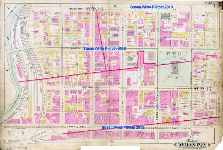
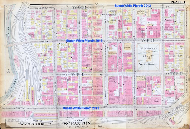
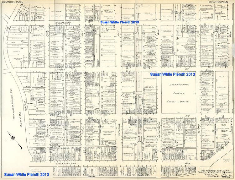
City of Scranton, PA, Maps: 1898, 1918, 1929

NOTE: These scans are provided by me, Susan White Pieroth, for your personal genealogy and history research. You may not copy them to another website (links are fine) or publish them in a book or on a DVD. If you think I might make an exception, please contact me. I do not sell prints, images on a DVD, or provide any specific image without the identification "stamps."
Below are three showing the businesses and residences within the same section of Scranton. I put these together to make comparison over thirty years easier. Because these were "stitched" together from six scans each, the information along the section lines may not be legible. See the full sections on the pages linked below each map.

1898, Graves & Steinbarger, Boston & Philadelphia

Click to open enlargement in a new window [over 1MB]
The full atlas can be found HERE.


1918, Volk & Kuehls, Philadelphia, PA

Click to open enlargement in a new window [over 1MB]
The larger scans of this plate are available HERE.


1929, Nathan Nirenstein, Springfield, MA

Click to open enlargement in a new window [over 1MB]
The larger scans of this plate are available HERE.

The text and images on this page may by saved for personal research, but may not be published in any form, including on another web site, without specific permission. Text and images copyrighted 2013 by Susan Carter White Pieroth 
Return to the Lackawanna County PAGenWeb Home Page